![]()
![]()
page 2 DESOLATION SOUND TO PORT MC NEILL, TOP OF VANCOUVER IS.
DATE: Wednesday, May 15th,
2002
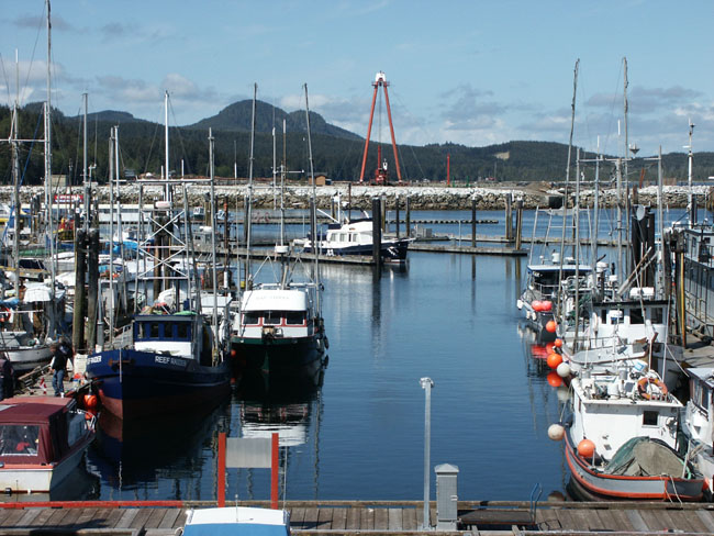
LOCATION: Big Bay
WEATHER: 45 degrees in the morning, sunny and beautiful.
DESTINATION: Unknown at the start but got all the way to Port Mc Neill
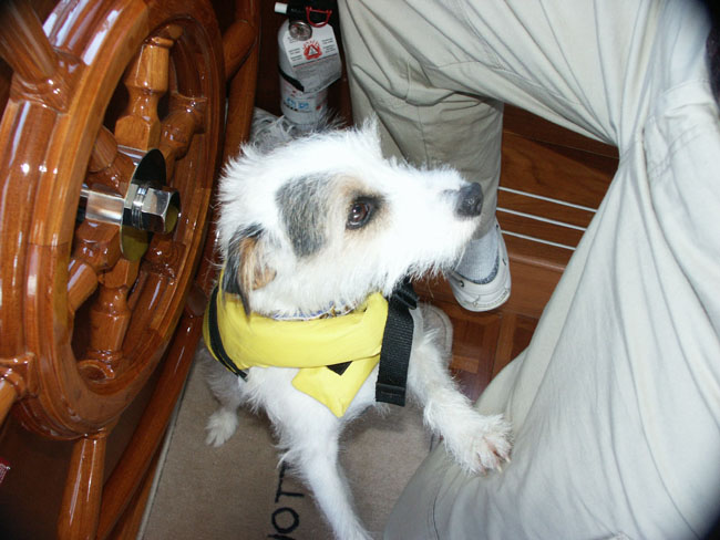
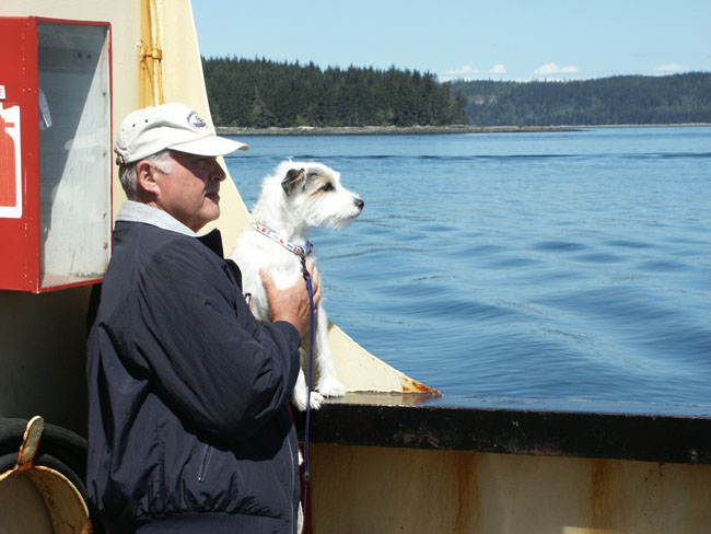
We got up at 6:00 AM. It’s sunny and beautiful out. The doctor’s boat left @ 5:30 AM. His boat is called “Sack Lunch”. I’m up and out with Ziggy. Zig was a little slower this morning. He’s not quite awake yet. Larry just called the “doc” on the radio and he’s an hour ahead. They’re trying to make it to Port Harvey before the bad weather sets in. That’s between W. Cracroft Island and E. Cracoft Island.
The “Maestra” and their catamaran companion are leaving at 7-7:30 for Billy Goat Anchorage in Johnstone Straight. We saw the catamaran loading up on water. Guess they got desperate and decided to take on the bad water. Yesterday she warned us not to take on their water, that it wasn’t potable. Their catamaran doesn’t look like a boat I’d want to take to Alaska but I’m sure they’ll make it.
We took off without any mishaps and looked back longingly to Big Bay as we headed towards the rapids. It was going to be a long day of negotiating currents and rapids and determining how far we could get before it became dangerous because of the weather.
We can see a lot of logging in this area
as there’s a lot of clear cut areas.
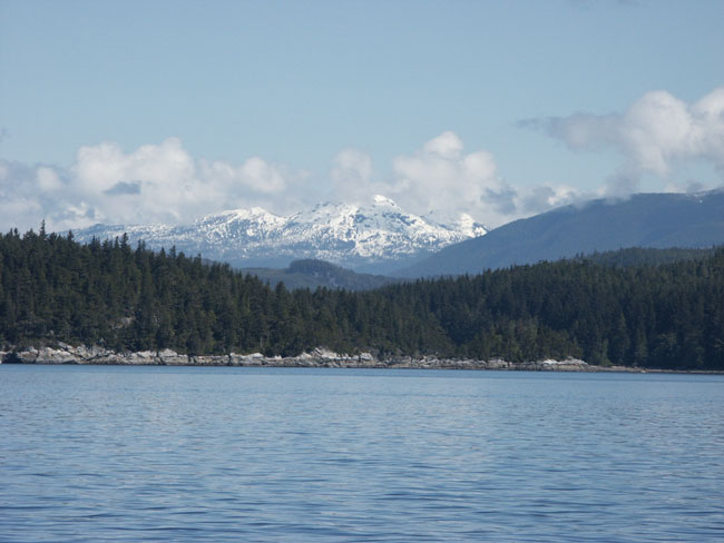
We passed Frederick Arm off Cordero Channel where Tony (the refrigeration man) and his wife were going. The place is called Oleo’s. You can dock overnight for the price of dinner, cash only. The scenery as we go along is beautiful with many snow capped mountains. Every so often we see little boats puttering around. Must be loggers going about their business. A bunch of logger’s came to the lodge last night for dinner – they were the ones gulping down those huge hamburgers like they hadn’t seen one in months. I guess that’s why Big Bay makes their meals so large and hearty. They are used to feeding these hungry loggers
(I can’t remember Tony’s boat name –guess that’s why it’s good to have a simple name. It was something French.)
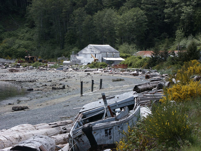
We are passing Shoal Bay. This was the site of an old lodge that burned down in 2000. The area looks very picturesque and one very old building on the docks is left. I bet it was a great looking place at one time. Sorry we missed it.
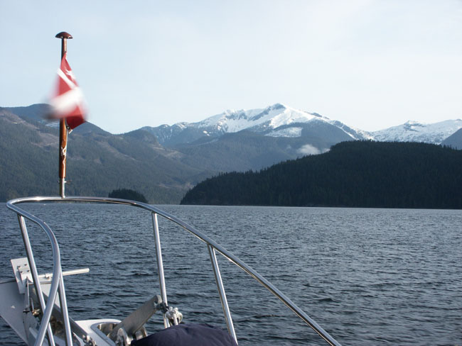
I took a picture looking down Cordero Channel to the snow capped Mountains as we were passing Brickly Bay.
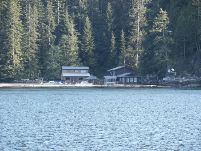
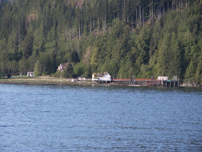
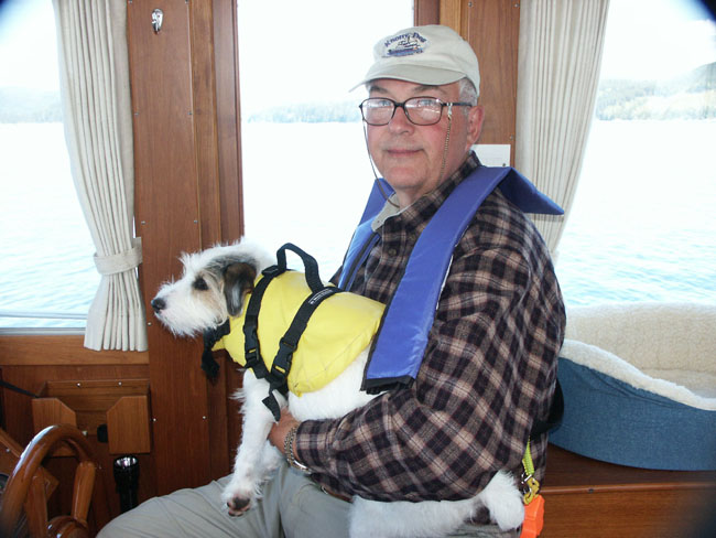
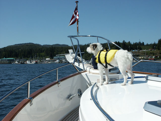
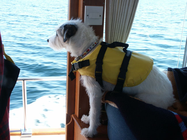
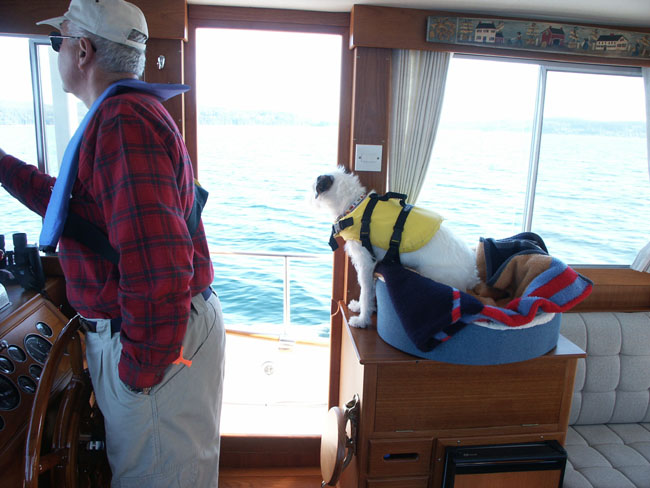
Ziggy says he hasn’t had a good howl in a long time. Larry says wait until we get landed and I can take him out for a good howl. It’s pretty uncomfortable going out on deck to take pictures because the chill factor is 35 degrees. We passed Cordero Lodge, a little German lodge and restaurant that everyone says is good. Looks like a fun place. It’s open mid May.
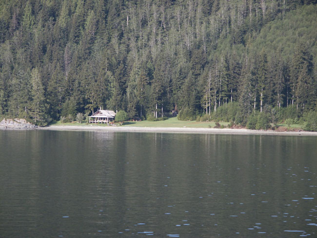
The weather is good and Larry wants to plods on. We pass Blind Channel which was our first option to stay overnight. There’s a beautiful log cabin and green space at the head of Mayne Passage and Cordero.
We just went through Green Point Rapids at Cordero Islands at 8:25 AM (an hour before full flood). It was pretty strong and scary. The rapid was pulling the boat right and left and there were some huge whirlpools on all sides. We were going through with the current so I wonder what it’ll be like an hour from now.
Larry just called “Sack Lunch” to see how they were doing and what the situation was up ahead. They said they went through Green Rapids an hour ago and said it was getting pretty rough. They were just getting ready to go through Whirlpool Rapids at Wellbourne Channel. They will call us when they are through and let us know how it is.
We’re at the intersection of Loughborough Inlet and the boat’s acting squirrelly. Larry said it’s because we’re riding with the current. The boat’s going 9.5 knots and 11 knots across ground. There are two channels coming together creating different forces. (Larry’s doing a lot of his throat clearing stuff – so I know he’s a little uneasy. That’s when I know he’s anxious.)
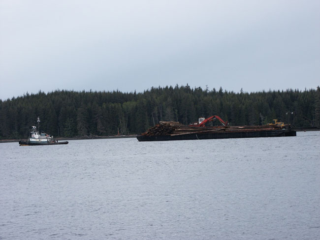
We pass two huge log pulls with tugs in Loughbrough Channel. One is going up and one is coming down.
 At
9:00, “Sack Lunch” calls on the radio. They just went through Whirlpool
Rapids. They said it was OK and we should not have a problem, to just stay in
the center. He said our radio transmission was breaking up and couldn’t hear
us anymore.
At
9:00, “Sack Lunch” calls on the radio. They just went through Whirlpool
Rapids. They said it was OK and we should not have a problem, to just stay in
the center. He said our radio transmission was breaking up and couldn’t hear
us anymore.
We are now turning from Chancellor Channel to Wellbourne Channel. We can now see the famous Johnstone Straight off our portside in the distance. It’s still to far off to see how rough it is. All the boaters seem to be wary and very respectful of Johnstone Straight as it can really be rough and windy at times.
I can see the marker up ahead for Whirlpool Rapids (don’t like the name one bit right now). I’m thinking about Johnstone off the Discovery Ship rowing all the way up Johnstone Straight to the Pacific Ocean. Here we are in our trusty Grand Banks, enclosed and safe. I can’t imagine being out there in a row boat with your destination unknown and untraveled.
The water’s getting squirrelly again as we move into the channel. I saw a row of white balls in the water. I thought they were markers for fishing nets but as we got closer they were perfectly shaped balls of foam formed from the uneasy waters. Really strange things, like nothing we had ever seen before.
We can hear “Maestra” on the radio talking to “Sail La Vie”. They just went through Greenpoint Rapids behind us. He called “Sail La Vie” to tell them it’s OK and what direction to take it. It’s quite comforting hearing people on the radio helping each other out. A lot of us are just strangers to one another but now were all in this together.
(“Sail La Vie” is a 30’ Catamaran, “Maestra” is a 46-48’ trawler that looks like a Kady Krogen but some knock off – they live on Whidbey Island. “Sack Lunch” the “doc” is a 46-48’ main ship semi-plaining hull)
We went through “Whirlpool Rapids” at 9:20. It was easy and next to nothing. Guess my Larry timed it perfectly. Whoops wait – it got squirrelly outside the channel in front of the entrance to Forward Harbor but didn’t cause us problems. We decided to pass Forward Harbor Anchorage (which is known to have some bears from time to time come that come to shore) and forge ahead while we have the good weather conditions. It was another of our options to spend the night.
We’ve turned into Sunderland Channel now. We’re out of the squirrelly waters. No more rapids today anyway. It seems very calm and we see “Sack Lunch” way up ahead. He’s at the entrance to Johnstone Straight. He must be about an hour ahead. Not sure what the distance would be. We are passing a log boom or a fish farm on the left and a small shrimp boat. There are lots of small logs to watch out for all through this area. The shrimp boat just pulled right in front of us and could care less.
 We’ve
decided to keep on going much farther than we had planned and try to make it
all the way to Port Neville.
We’ve
decided to keep on going much farther than we had planned and try to make it
all the way to Port Neville.
I forgot to mention that last night when we went to dinner, I saw “Maestra” and “Sail La Vie” knocking at the back door to the kitchen at Big Bay asking if they could pick up their groceries. The kitchen staff gave them a couple plastic sacks of food. It looked like a loaf of bread, green onions and some other things. (“Sail La Vie” said yesterday they were running out of food and water and had hoped to provision at Big Bay but the store wasn’t open.) I guess the staff at Big Bay decided to help them out with whatever they could share from the kitchen. They are a nice bunch.
We heard “Sack Lunch” talking to a boat called “Velocity” (a sailboat we would later become very friendly with). “Sack Lunch” was admiring the sailboat and told him so on the radio.
Johnstone Straights are a little choppy but the conditions are good. There is a large tug up ahead with a huge log pull.
Larry talked to “Sack Lunch” again. They’ve decided to keep going all the way (7 hours) to Port Hardy. We decided since the weather is so good, we are going to pass Port Neville and plan a stop there on the way home. We’re going to Port Mac Neil. We had considered docking at Alert Bay which is nearby but read the docking there isn’t so good, so we’ll visit it by ferry.
We’re very carefully watching for logs. We have seen many. Many logs have fallen off the tug load that went by.
The weather is sunny with patchy clouds. We are going to pass “Velocity” before we reach the entrance to Havannah Channel at Cracoft Island. There is another shrimp boat headed down the channel. It’s empty. It has either dropped its pots or is going to pick up its catch. They remind me of Chinese junks.
Its 11:30 and we’re all getting hungry from this big morning. I’m heating up the pea soup that I made at Refuge Cove. Ziggy's eating a couple dog biscuits. We pass a big white house on Milly Island at the entrance to Port Neville.
 As
we look down Havannah Channel we can see a big interesting red roof on E.
Cracroft Island deep inside.
As
we look down Havannah Channel we can see a big interesting red roof on E.
Cracroft Island deep inside.
I hear knocking sound by the shower. We’ll have to check it when we reach Port Mc Neill. Ziggy and I decided to take a little nap.
We can still see “Sack Lunch” ahead.
He’s still about the same distance in front of us as before. We must be going
the same speed.
There are islands on the right. They are lower and flatter than what we’ve seen so far on the trip. Vancouver Island is on the left. It’s still steep and snow capped.
Its 1:00 PM and we’re just reaching Hanson Island on our starboard. We’re listening to the weather report. It’s warning of a gale force storm coming up. Larry says we made the right decision to head on to Port Mc Neill. We’re still keeping an eye out to avoid the many logs that are floating around everywhere.
Larry called “Sack Lunch” again after listening to the weather report. They said they heard there was going to be 12 foot seas so they’ll get to Port Hardy and wait for it to blow through. Johnstone Straight is uncharacteristically flat as a pancake. I guess it’s the “calm before the storm”. We’re about 8 ½ miles to Alert Bay and 6 more miles to Port Mc Neill. Its 48 degrees, brrrrr!
It’s a long slow crawl to Port Mc Neill against current. It’s really slowing us down.
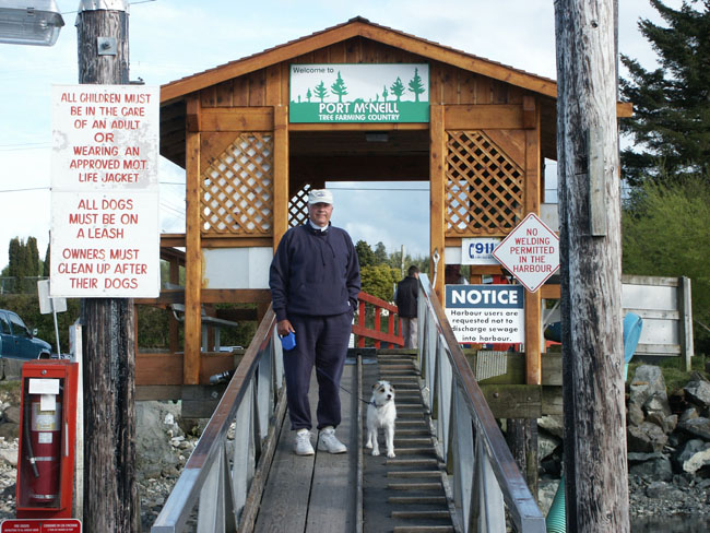
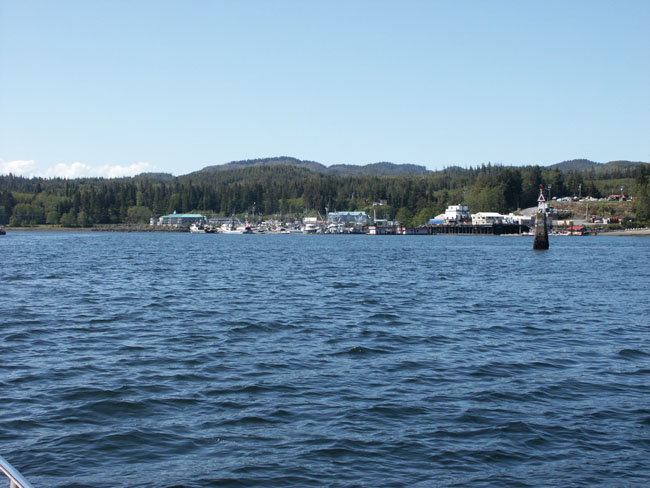
As we arrived at Port Mc Neill, Larry called the harbor master but no answer so we docked where we wanted which has been pretty much the way it’s been since we started this trip. There is lots of room.
Wow, Port Mc Neill is quite a cultural shock after where we’ve been. There is lots of ferry traffic, and a water taxi raced us in. The school ferry was leaving and blew an enormously loud horn that scared the bajiggers out of us. There are helicopters taking off and landing and sea planes doing the same. There are lots of fishing boats coming and going and leaving their wakes that rock us at the docks. There are people on a barge across the way doing repairs. They are hammering a repetitive knocking that is becoming more and more irritating. After where we’ve been it was almost too much.
Larry had backed the boat in to the
dock. He’s learned to dock the boat now from the inside as its too darn cold
outside on the fly bridge. There were lots of obstacles on the dock when I
jumped off to tie the boat. There was an electrical plug-in box, water
spouts, pier posts and loose planks of lumber. We docked with no problems
though.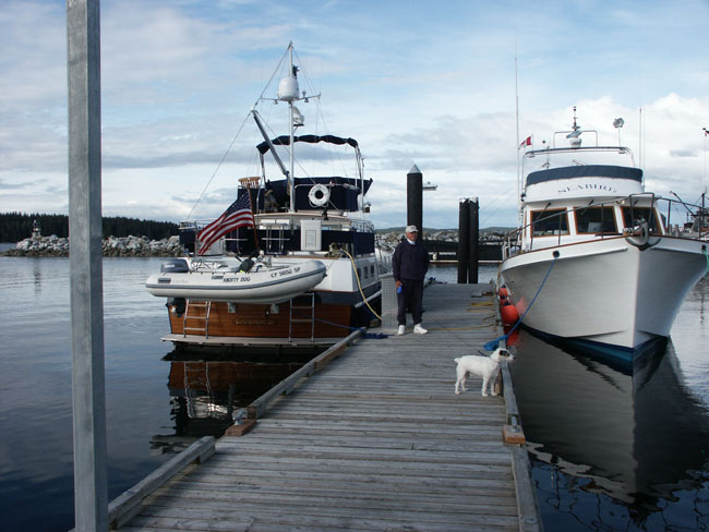
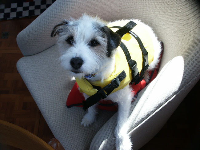
I took Ziggy out immediately. He had been very patient all day. It was a long day for him. People were very friendly. They have a nice grassy walk along the waterfront lined with poop bag dispensers and trash cans for taking care of your dogs. There are picnic tables and large trash bins for boaters and a bulletin board advertising all kind of businesses and services that boaters might need.
We walked up to the harbor master’s office to check in and a huge German Sheppard practically attacked us (Zig and I). I had to retreat backwards so fast that I almost fell. She (the harbor master) never said a word. No apology, nothing. What a different world up here.
Larry washed and wiped the boat down. I couldn’t help because I was too tired. I sat on my chaise lounge.
Later we walked around town. They have a
nice grocery store, plus another up the road, a coffee shop, hair stylist,
Laundromat (no laundry), large drug store, radio shack, marine store, pub, ice
cream and sandwich shop, steak house, and a place to charter sea planes and
adventure tours. We’ll be comfortable here to weather out what might come
with this storm.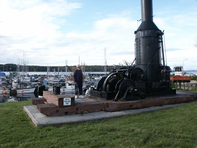
Larry and I walked to the market and picked up some fresh produce. Dinner was a big salad with everything possible in it and spaghetti with homemade pesto and parmesan cheese.
To bed.
DATE: Thursday, May 16th,
2002
LOCATION: Port Mc Neill
WEATHER: 50 degrees
DESTINATION: Stay put
 We
awoke at 5:30 AM because the boat across the dock was leaving and he was
making a lot of racket by our window unscrewing his power hook up, etc. The
boat that was leaving was rented out of Anacortes by some people from
Tennessee. It was a 36 foot Bayliner (gas powered), a son, mother and
father. They had six weeks to go to Glacier Bay and back!! They took off in
this gale storm weather! Hopefully they went to Port Hardy and waited the
storm out there or as Larry said “they had one hell of a ride.” They came up
from Lund to Port Mc Neill in one day. Crazy. What’s the point? He said he
doesn’t need a reservation for Glacier Bay if he gets there before June 1st.
(They did make it because we did meet up with them again in Wrangle on their
way back as they tried to raft up to us.)
We
awoke at 5:30 AM because the boat across the dock was leaving and he was
making a lot of racket by our window unscrewing his power hook up, etc. The
boat that was leaving was rented out of Anacortes by some people from
Tennessee. It was a 36 foot Bayliner (gas powered), a son, mother and
father. They had six weeks to go to Glacier Bay and back!! They took off in
this gale storm weather! Hopefully they went to Port Hardy and waited the
storm out there or as Larry said “they had one hell of a ride.” They came up
from Lund to Port Mc Neill in one day. Crazy. What’s the point? He said he
doesn’t need a reservation for Glacier Bay if he gets there before June 1st.
(They did make it because we did meet up with them again in Wrangle on their
way back as they tried to raft up to us.)
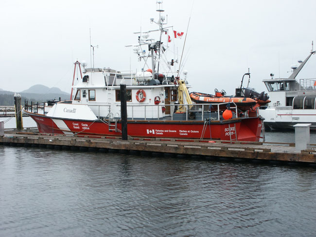
At 6:30 AM, the Coast Guard arrived and docked near us.
We tracked the weather all day and we were very glad we came here to sit the storm out.
 Larry
fixed the toilet that was not sealing. We had to turn the pump off after each
use. The air was leaking through and it was making an annoying whining sound.
The water would continue to empty and then whine.
Larry
fixed the toilet that was not sealing. We had to turn the pump off after each
use. The air was leaking through and it was making an annoying whining sound.
The water would continue to empty and then whine.
The veggies are doing great in the Ever Last bags and the cheeses are doing equally well in the Food Saver sealing bags. All is well in the storage department.
We went to get coffee and check our email
at the Community Education Center. It was a very nice place. They have a
modern set up with several computers. We just went in and logged on. It was
free. We looked up our checking account to make sure our deposits came
through OK (they did) and checked the Visa balance. Everything looks OK so
I’ll take the info and enter it into Quicken and correct the Visa entries for
the Canadian exchange on the lap top.
The TV reception is good here. Larry’s arranging to have his Pacific Northwest book mailed to the Harbor Master here. He’s been trying to get it for weeks but there was a delay in the publication. They called us on the cell phone and said it was finished. Hope it gets here before we leave.
I forgot to mention there were (2) big boats here when we came. One that we saw at Ganges called “Lavender Rose”, a 65-70’ and “Important Business”. They also left early this morning going to Sullivan Bay (near Minstrel Island). It’s supposed to be a fun spot with loads of docks named with street names. Wonder what it will be like in this weather? Hope they are making the right decision. At least we have the town to mill around in while we’re stuck waiting out the bad weather.
Weather Conditions at Port Mc Neill
|
Time |
Temp |
Wind |
Pressure |
|
9:00 AM |
50 degrees |
10 NE |
1019.0 |
|
12:00 |
55 degrees |
15 NE |
1013.1 |
|
3:45 PM |
53 degrees |
17 SE |
1011.2 |
|
5:45 PM |
49 degrees |
10 SE |
1010.0 |
We’ve been listening to the weather report and are having some difficulty understanding the names of the locations for the report. I’m trying to write down the names and locate them on the map. The report first gives the Lighthouse Reports with the following stations: Mc Innes Island, Asbrooke Island, Egg Island, Pine Island, Scarlett Point, Artine Point, Pultiney Point and Cape Scott. Then follows the Automated Report with the following locations: Sandy Island, Herbert Island, Cathedral Point, Dixon, Sartine Island, Solander? Island. Finally comes the Ocean Buoy report with the following stations: South Hecate Straight, South Monessey, West Sea Otter, East Delwood, and South Brooks. At least that’s what we made them out to be. Its difficult understanding the automated or computer voice at first and the names are not familiar. It’s taking us awhile to get familiar with these locations and then understand how it will affect us and our location. We spend time just listening to the reports over and over trying to make it second hand.
You do a lot of snacking when you’re stuck at port. It’s OK when we’ve been hiking and working hard but days like this are going to get us fat.
DATE: Friday, May 17th,
2002
LOCATION: Port Mc Neill
WEATHER: 44 degrees
DESTINATION: Stay put
Today is the big Canadian “Victoria Day Weekend” holiday, which to us is Mother’s Day. It’s cold this morning. We woke again at 6:00 AM. Ziggy is pigging out on the bed and taking all the space. We managed to go back to sleep until 8:00. Larry got up about 7:50. It was good to sleep in.
The winds have died down slightly but it’s cold and overcast with slight sprinkles. We took Zig for a walk, stopped at the internet store and looked at emails from friends.
We stopped at Field’s, a discount store, and bought a replacement pair of sweat pants, a second pair of flannel PJ’s (I think I’m going to need them), and a few other things.
It’s raining heavily now and Larry is installing fans to prevent the windows from fogging up. He wisely had Canoe Cove put a wire in for him to hook to so we don’t have to drill anything or have wires hanging all over. The installation looks good and we can remove them when done or if they don’t do the job.
A 35’ trawler pulled in beside us called “Seabird”. They are a very nice and friendly couple. They’re from Santa Monica originally. They have done a lot of cruising in The Channel Islands near Santa Barbara, CA (where we’re from). He said he remembers the SBYC (Santa Barbara Yacht Club) in the 60’s when it was “nothing.” They’re on their way to Alaska too. I’m looking forward to talking with them when the weather gets better. They came in from Lagoon Cove on Minstrel Island to get out of the storm.
We read most of the afternoon on where we’re headed. Another Grand Banks pulled in. A 32’ Grand Banks called “Sunday”, two guys from La Conner.
“Seabird’s” dog poops in a box with Astro turf. They said they “taught the dog, day-one, to poop and pee on the boat”. I feel sorry for the dog. They never took the dog off the boat since they arrived and it seems like it’s not allowed inside the boat either. Why bother having a dog? Poor thing.
We walked to town again. We checked out a hardware store and another gift shop. Nothing sophisticated here.
The sun is breaking through finally and we took advantage by taking photos of the harbor.
DATE: Saturday, May 18th,
2002
LOCATION: Port Mc Neill
WEATHER: 48 degrees
DESTINATION: Stay put
It was 43 degrees at 8:00 AM and no wind. There were a few low hanging clouds. The water’s flat as a pancake. “Seabird”, “Saturday” and the sailboat left early. The weather forecast is good.
At 9:00 the sun is shining brightly and its 45 degrees. We’re going on the 11:00 ferry to Alert Bay. We’ve been reading about it and are anxious to see it. It’s an Indian village on a nearby island.
We vacuumed up the boat up a little as there is so much lint from our new sweat pants that it’s ridiculous. We closed the curtains and actually put the sun screen over the front windows.
We listened to the weather report again. It’s a total change. Everything has turned to moderate. It would’ve been a good day to go “across.” It’s a weird feeling when all the other boats leave and you’re left all alone on the dock. You feel really left out and wondering if you should’ve gone with them. You wonder if you will see any of those people again.
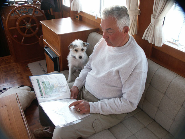
We are still struggling with the weather reports and working on understanding and interpreting what they mean: I take endless notes trying to get a handle on it:
LIGHTHOUST REPORT Sky Visibility Sea Swell
Mc Innes Is
cloudy 15 ripple
Ashbrooke Is partly cl
1
Egg Island partly
cl 15 1’ NE 7
Pine Island
“ 15 ripple
Scallette Pt
“ 12 ripple
Pultney Pt
overcst 15 ripple E10
Sartine Pt clear
15 ripple W8
Cape Scott
15 1’ chop NE4
Quatino Lt
W
AUTOMATED Wind Barometer
OCEAN BUOYS
Sandy Is. SE
4 013.5 up
Halibut Is. E 4 1012.7 down
Cathedral Pt. NE 9 1014.5 down
Dixon NA
Sartine NE 10 1013.5 down
Solander Is. S 5 1013.9 up
OCEAN BUOYS Winds Combined Seas Press
S. Hecate Straight
3 1014.3
S. Monesegy NE12 2 1014.3
falling
W. Sea Otter N 6 1.7 1013.2
falling
E. Delwood NE10 1.8 1013.4
falling
S. Brooks SE6 2.1
1013.3 steady
This report would be a GOOD DAY for crossing! We notice that the reports are broken up into these locations:
North Coast Waters: Moderate Easterly
winds
South Coast Waters: Light to Moderate
Straight of Georgia:
Johnstone Straight: Small craft warning
Queen Charlotte Straight: Easterly 15 knot winds, seas at 2 meters.
Queen Charlotte Sound: 5-15 knots
Central Coast:
Its taking us awhile to sort through the reports and understand what applies to us where we are and where we are going.
Well enough of these weather reports. Off to have some fun! We left to catch the 11:00 ferry. We stopped at Mc Neill’s (which is a little takeout café near the marina) for coffee before we left. We sat out on their little patio deck. Other people were there doing the same or having breakfast. The sun was out and it was getting warmer. It’s going to be a nice day.
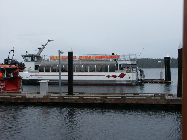
It’s a small ferry, not like what we are used to from Anacortes to Friday Harbor. Lots of Indians boarded. Many are short and chubby and flat faced. It was a forty five minute ride. We talked to the guy that worked on the ferry. He said in the winter there are some scary rides. Some are in 40-50 knot freezing winds. The captain is from the Baltic and has no problem handling the conditions. He said it was a big day at Alert Bay today. The Indians are having a potlash and a wedding. It’s a private potlash in one of the houses. He said that it’s also a big day on the other island. Malcolm Island is celebrating Finnish Days. We’re thinking maybe we can stop by there with our boat tomorrow on the way to Port Hardy.
Alert Bay, at first sight, seems kind of dilapidated. When you step off the ferry dock you are greeted by two carved arches that have greetings carved into the wood. They are nicely carved and painted. They are a backdrop to the old cannery buildings that are barely holding together. Moss is growing all over the buildings and remains of any paint it might have had is barely showing. Many boards are missing and rotting. The other buildings along the road are pretty shack like and then there are some very old cottages, some painted bright colors. The oddest thing amongst all this decay was the brand new asphalt road that swathed its way through town barely leaving a building standing. It just seemed to over take the village paving its way practically over the fragile old buildings. It really took away from the old character of the village. It’s so new and the buildings are so old and tired. It doesn’t make sense on this small island to have such a road. An old gravel road would have been just as serviceable and much quainter.
We walked down to the information center to see where we could have some lunch. The lady said she wasn’t allowed to recommend any specific one. She said it was either the pool hall at the ferry entrance, two other places that offered Chinese food or the Orca Inn (which she slipped and said was a “really nice” restaurant and they have great fish and chips). We decided to go there obviously.
We walked past their new boardwalk on the waterfront which is so over designed for the town. It looks as out of place as much as that new asphalt highway. Someone must have sold them a bill of goods on street lights too. The only thing that was right about it was that we could get off the too new sticky asphalt.
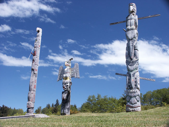
We came to the Indian burial grounds.
There were 10-20 totem poles ranging from old decaying ones to brand new.
This site alone was worth the trip. A couple black Ravens were guarding the
poles and screeching at us to go away. It was beautiful to see this place.
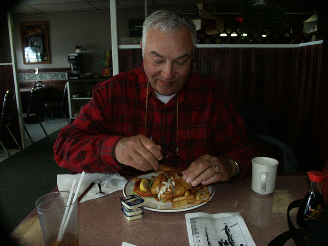
We stopped at the Orca Inn for lunch. It was better than anything else we’d seen in town but I wouldn’t call this a very nice restaurant. Larry had fish and chips and miss spoke when asked for malt liquor instead of malt vinegar. The waitress got a big kick out of that. I had grilled halibut and rice off the dinner menu. Had to pay dinner price with out all the goodies that come with it. The fish tasted like it was frozen and over cooked. Zig liked it. Fish and chips were good though. We left Ziggy at the front door with his new mussel. He watched us forlornly as we ate.
We had walked the length of town along the shore to the right of the ferry landing to get to the Orca Inn, now we had to walk back and continue on past the ferry landing to get to the cultural center and also be back at the ferry landing by 3:00.
We saw lots of interesting things to photograph. It’s really a photographer’s paradise. There are old beached boats on the shore. There also is a lot of trash everywhere. Indian kids were eating fast food and think nothing of leaving the trash everywhere. The beach is littered with broken glass, beer bottles, old junk, boats, bikes, farm equipment, and leftovers from carving projects. Some houses are so rundown that you can’t possibly imagine someone could live in them.
Some of the people we saw were dirty and way over weight. What do they do to live as it doesn’t look like they have jobs. How do they survive? Must be government subsidies? The area seems economically dead.
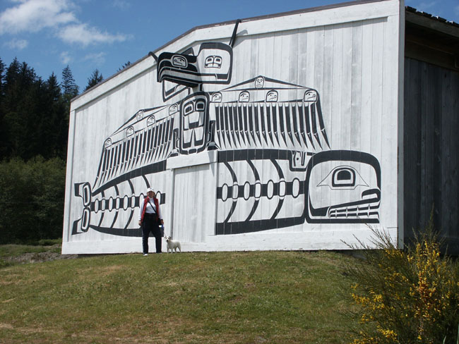
The cultural center on the other hand is a new, expensive, nicely designed building. No expense is spared there. It is a harsh contrast to the rest of the island. The exhibits are beautifully designed with wonderful things. They have a nice gift shop. The exhibits were mostly about the whites taking away their potlash rights and artifacts.
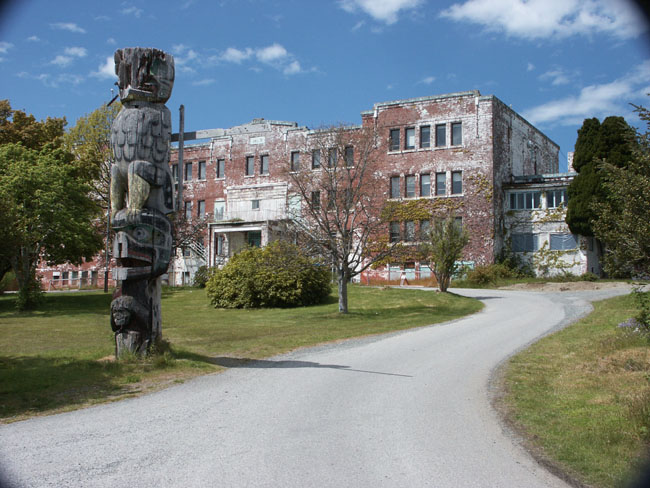
There is an old ghost like Indian school next door. It’s empty and useless now. Looks like a good spot for the movie “The Shining II”. We saw what they say is “the tallest totem pole” in the distance but we had to hurry back to the ferry because we could see it was coming.
We got back to ferry just in time. We always have to ride on the bottom deck with the cars because of Ziggy. We saw four trawlers coming our way looks like four cruisers traveling together headed towards Alaska.
We had dinner that night at the Sportsman’s Lodge. It had a mixture of items on the menu including Greek food which always surprises me how many Greek restaurants there are in this part of Canada.
I took Zig for a long walk while Larry
took a shower. He was very tired. We’ll leave for Port hardy tomorrow.
Larry’s book never arrived.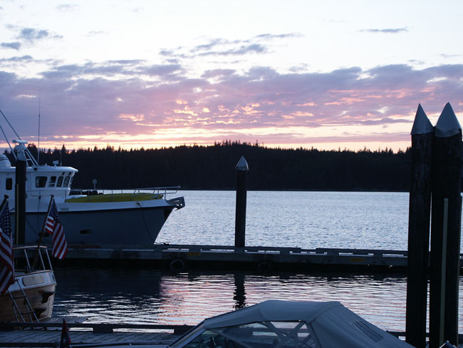
Strong winds came up at dinner but are gone now. It’s 50 degrees and the weather report sounds good for tomorrow.
A Nordhavn snuck in while we were out. It docked off on its own. The boat is called “Hapgood”. Their name plate said Sioux City, Iowa. (We don’t know it yet but we will get to know them a lot better.)
DATE: Sunday, May 19th,
2002
LOCATION: Port Mc Neill
WEATHER: 46degrees
DESTINATION: Port Hardy
We’re set on leaving Port Mc Neill today
and our destination will be Port Hardy. At first we thought the Nordhavn that
came in yesterday was the same unfriendly Nordhavn that we had seen at Nanaimo
and Melanie
Cove but have decided it’s a different couple. The man looks older and he’s
balding. They took off about 30 minutes ahead of us.
It’s sunny and calm out. We wish we had had time to see Sointula on Malcom Island but will have to plan to do that another trip. It’s a little Finnish town and is supposed to be very picturesque. They are celebrating their 100th anniversary this weekend.
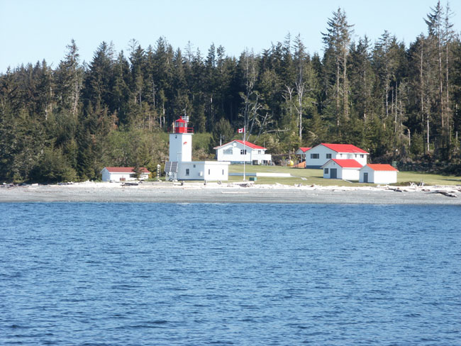
We passed Pulteney Point Lighthouse on our starboard side. It is composed of several buildings, crisp white with bright red roofs. The lawn is groomed and they have a lovely white greenhouse in the back. The place is immaculate. Trait of the Finnish I guess. It’s supposed to be a manned lighthouse according to Charlie’s Charts.
The Nordhavn is the only other boat around. It’s ahead of us quite a distance and hugging the mainland. I hear that knocking sound again. It’s like a ghost. Larry’s going to have a diver check the bottom of the boat in Port Hardy to see if anything is loose.
It’s a clear day, no waves or swells. We’re catching up with the Nordhavn and passing it as we enter the channel to Port Hardy. We’re watching the Nordhavn behind us take a short cut through some small islands and rocks at the entrance to the harbor sound. Pretty risky I’d say. We stopped at the fuel dock first and loaded up. A woman came down to greet us and tell us that they were admiring our boat at Port Mc Neill. Turns out she was from the Nordhavn we had been following and her name was Margie. She was very friendly and nice. They’re headed north also. I said we’d chat when we got docked. I gave her our boat card. Their names are Margie and Richard. They are really nice people.
Another guy came in to the dock all by himself on a 42’ sailboat. He was very friendly. He’s a young ex-Microsoft executive, now retired. He said he had been to Alaska several times. He’s building a house in Hawaii. Everyone is becoming friendlier as we get farther North.
The dock has some funny dock hooks. They are metal upside down u-shaped loops. It’s always a challenge to adjust to each new way of tying the boat up. At each new port we’re not exactly sure what type of situation I will encounter at the docks.
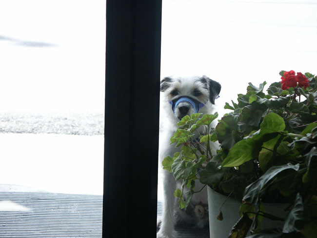
We walked up to the pub with the guy from the sailboat and had lunch with him. He gave us some pointers on good places to go as we head North. Right of the bat he said he doesn’t like Wrangell or Petersburg. He said the currents are bad for docking. I had to tie Ziggy out at lunch with his muzzle on. It made us both very uncomfortable through lunch worrying about him.
The marina is a nice place with a cute hotel and a nice marine shop. The hotel has a Jacuzzi that the boaters can use and they provide robes, shoes and towels. It’s nothing fancy but a luxury to us this far. They also have nice showers and a decent laundry.
It’s a short walk to town. There’s not much there of any interest to us that we could see. It’s like a ghost town this early with no one around. Everything was closed up for the holiday weekend too. I noted where the grocery store is and the “mall” that everyone was talking about (looks like a small strip mall).
We decided to stop at the marina restaurant for dinner. We were pretty tired and didn’t have the energy to go to the boat and then walk back again. Margie and Richard came in and joined us. I had to leave Ziggy outside again tied up with the muzzle on again.
Margie and Richard have only had the boat for two years. They brought the boat up from San Diego. Margie does the entire computer plotting and he docks and drives the boat. They are retired. He used to do financial planning. They don’t seem to be afraid or apprehensive of anything. They say they will be leaving tomorrow about 8:30 AM. Hope they’ll be OK.
We are early on our schedule. In fact, we are farther north than the insurance company was prepared to insure us for. Larry had to call and get a waver to go North sooner. I don’t know what Margie and Richard’s rush is to get going. I’d rather wait for a good weather window.
I left dinner a little early because I was concerned about Ziggy sitting outside. Margie came out and walked with me back to the boat. She forgot Richard had her key to get in. I invited her in and showed her the boat. When Richard and Larry came, we gave them both a tour of the boat. We then went over and saw their boat. Very nice but a little cramped for me.
Hope they’ll be safe tomorrow.
DATE: Monday, May 22nd,
2002
LOCATION: Port Mc Neill
WEATHER:
DESTINATION: Stay put
The “Hapgood” left at 7:30 Am. He turned completely around at the dock. It was amazing because they were backed way in a corner and he had not much room to do that. I would’ve backed out instead but he did a good job.
We decided today was laundry day. I was unable to find a laundry service in Port Mc Neill and Larry talked me into waiting until we got here. We thought there would be someone here that could do the laundry but no such luck, so I sorted all the whites, darks, and spray treated the spots. I bundled everything up and Larry got the green dock cart and loaded it all and off we went.
It was a nice laundry as laundries go. Better than expected for the remoteness of the place. One machine was out of order. The floor could’ve been cleaner. You enter by passing a row of shower rooms. I had about five loads so I pretty much gradually took over each machine as the guy there before me emptied his machines out. He was from Nebraska on his sailboat “Velocity”. It was his second summer doing this. He was quiet at first but we were stuck in the room together and we managed to get a conversation going. Little did I know he would become a big part of our trip in the following weeks. He was a cattleman and farmer. He learned to sail in the Boston Harbor too and went to school at Harvard. His wife is living in Santa Fe all summer so it sounds like they live separate lives. Last summer he went around the West side of Vancouver Island.
Another couple from Alaska came in. They had been living in Alaska for 24 years and were now beginning a trip sailing down the coast to Monterey, CA and then on to the Galapagos Islands and who knows where else. Their names were Bruce Jones and Jenny. They may stop and visit us in Santa Barbara on the way down. He has been working on the oil line and she for the forest service. They ran their boat for 14 hours before they docked. You could tell they were tired as they were having trouble docking. We helped pull them in. They are very nice people.
We soon realized long ago that the farther north you get don’t expect to get help docking your boat anymore. You’re now really on your own. Guess they figure if you’ve come this far you can manage.
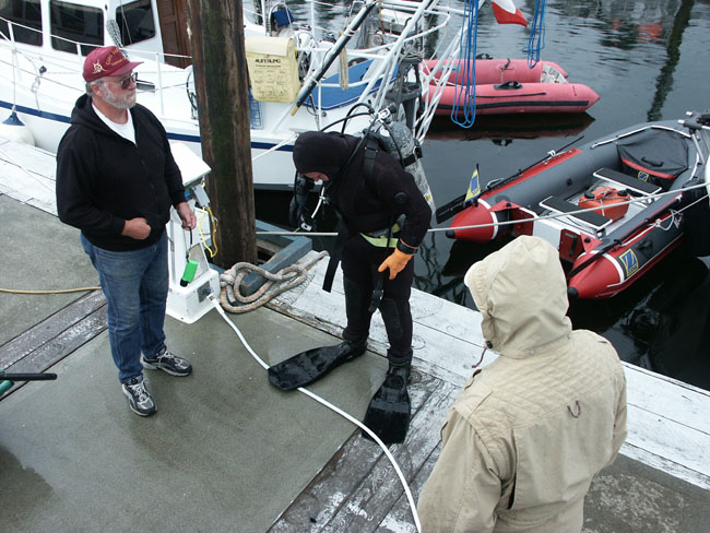
Larry was waiting for a diver to come to see what was knocking under the boat.
Four or five boats came in all at once
after lunch. Two of them, “Raven” and “Patience”, asked if we wanted to tag
along tomorrow for the Dixon crossing. We said “yes”. Everyone on the docks
were talking, friendly, and checking to see what each others plans were for
the crossing. They were all discussing the weather and what directions they
were going. Again, we met some more people that would become a big part of
our adventure for the next several months and that would be the people on
Raven and Patience.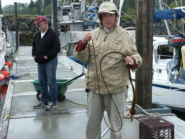
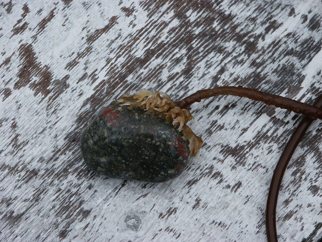
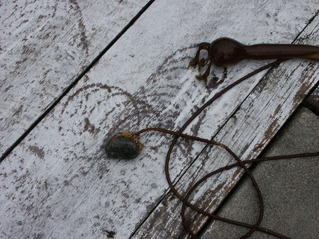
The diver finally came at 4:00 PM. He quickly found one of the long sea weeds that look like a snake with a head on it wrapped around the starboard stabilizer with a rock attached to the end. The rock was about 2 ½ inches round and the sea weed had attached roots around it and would not let go. The rock had red paint on it from hitting the bottom of our boat. It was amazing how that thing hung on so long.
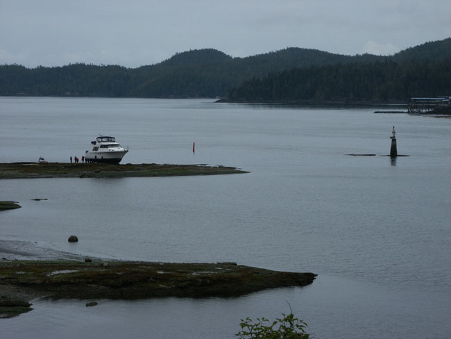 This
afternoon a large yacht beached itself on the shoal at the marker near the
entrance to the harbor. I walked out to the beach to see it. It was a 55’
Ocean Alexander which lodged itself totally on top of the shore rocks.
Apparently it went to the right of the marker instead of the left. Zig and I
walked out to the beach to take some pictures. A few townspeople were
checking it out also. I ran into the captain walking to town trying to find
someone to help. I mentioned it was too bad about the accident and that the
harbor entry can be somewhat misleading. He grumbled, and said, “Not if you
read the charts”. The rumor was that his wife was driving the boat.
This
afternoon a large yacht beached itself on the shoal at the marker near the
entrance to the harbor. I walked out to the beach to see it. It was a 55’
Ocean Alexander which lodged itself totally on top of the shore rocks.
Apparently it went to the right of the marker instead of the left. Zig and I
walked out to the beach to take some pictures. A few townspeople were
checking it out also. I ran into the captain walking to town trying to find
someone to help. I mentioned it was too bad about the accident and that the
harbor entry can be somewhat misleading. He grumbled, and said, “Not if you
read the charts”. The rumor was that his wife was driving the boat.
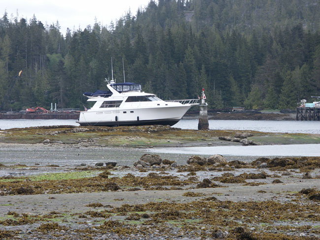
Later I was later talking to the fuel dock guy and asked him if that happens often and he said at least one a year if not more. He also said it was a real money maker so I think the locals are not real anxious to mark the entry a little more clearly. The boat sat there all day. It had to wait for the tide to come in and then a tug was able to go out and free it and bring it in about 9:00 PM.
Larry was busy getting ready to leave tomorrow. He was filling the water tanks but it was taking forever because the water pressure was down. Apparently everyone on the docks was doing the same thing. Everyone was readying their boats, securing ropes, etc.
We walked to the market to get a few things and called a cab to bring us back. The owner of the marina offered us his pick up truck but we walked instead. Nice guy. The market is pretty good. We had the cab drop us off at the Pub for dinner and left our groceries inside the door of the restaurant while we ate.
Larry had the seafood special plate with halibut, sautéed shrimp, pan fired oysters. The oysters were delicious and sautéed shrimp come with everything you order up here.
We checked the charts for tomorrow and planned our route and hit the sack about 9-9:30 PM because we had a big day ahead of us and were planning to leave early at 5:30 AM to cross the Queen Charlotte Sound.